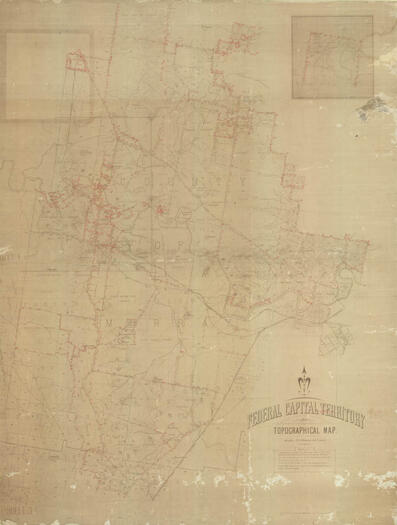
#24144 - Duntroon Fence Map (Brackenreg)
- Resource IDLocation
- 24144Map Room, drawer 14
- Title/subtitle
- Duntroon Fence Map (Brackenreg)
- Author/Creator
- Department of Home Affairs, Lands and Survey Branch, Canberra
- Picture
- Format
- Map
- Publisher
- Department of Home Affairs, Lands and Survey Branch, Canberra
- Physical description
- Paper - large format
- Summary
- Describes fence lines by numbers of strands of wire. The base map is Federal Capital Territory Topographic Map. 20 chains to 1 inch. June 1913.
- Availability
- Not for loan. Digital copies available for purchase.