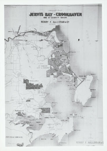
#16170 - Jervis Bay area map showing Crookhaven and St Georges Basin
- Resource IDLocation
- 16170Photograph 2467
- Title/subtitle
- Jervis Bay area map showing Crookhaven and St Georges Basin
- Picture
- Format
- Photograph
- Identifier
- Planning; town planning
- Publisher
- [n.d.]
- Physical description
- Black & white photograph of plan; 11cm x 16cm
- Summary
- Planned sub-division of land in Jervis Bay, Crookhaven and St. Georges Basin by Henry F. Halloran & Co.
- Availability
- Not for loan. Copies available for purchase.
- Notes
- Refer to Canberra Historical Journal edition 17 of March 1986. The planned sub-division had 3800 allotments and hundreds of people bought blocks over a decade, but the Great Depression killed the project off.